Recent expeditions document a new cave system in Papua New Guinea and a massive glacier break in Greenland
Within days, exploration teams in two of the world's most remote environments made significant discoveries: a pristine underground network in Papua New Guinea's Nakanai Mountains, and an 18-million-tonne glacier calving event in East Greenland.
.jpg)
Days before packing up their gear, a caving expedition in Papua New Guinea’s Nakenai Mountains finally found what they had been searching for after weeks of exploration: a new cave system filled with crystal-blue lakes, waterfalls, and underground rivers. The discovery, reported by the expedition’s sponsors at Petzl, underscores how much of the planet’s subterranean world remains unmapped, even as the science of Speleology pushes into increasingly remote frontiers.
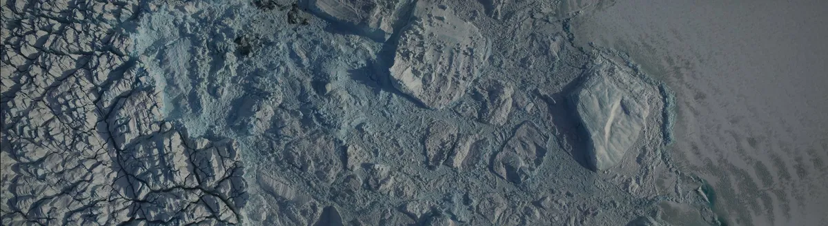
While that team was emerging from the dark, another was facing the opposite end of the planet’s hydrological cycle in full daylight. A team of scientists aboard the RRS Sir David Attenborough captured footage of a massive glacier calving event in East Greenland where a 1km-wide section of glacier front broke away, totaling an estimated 18 million metric tonnes of ice, according to the British Antarctic Survey.
Both findings are snapshots from the outer edges of logistical feasibility. The Papua New Guinea expedition required weeks of trekking and climbing just to reach their target area, a testament to the physical challenge of pure exploration. The calving event was witnessed from a dedicated polar research vessel, a platform that exists precisely to put scientists in position to record phenomena that are both routine in the glacial cycle and catastrophic in scale.
What links them is timing. The cave discovery came at the literal eleventh hour of the expedition, a reminder that success in field science often hinges on persistence in the final days before a scheduled departure. The glacier calving, while a predictable consequence of ice dynamics, was a transient event captured because the right people were in the right place with the right equipment at the moment it happened.
Neither event, on its own, rewrites a scientific discipline. The new cave system extends the known boundaries of a specific karst region. The calved ice will contribute a measurable, if small, increment to sea-level rise models. Their significance is more elemental: they are direct, recently gathered observations from two of the least-observed environments on Earth.
They also represent different modes of engagement with the planet’s extremes. One is an act of deliberate intrusion, of entering and documenting a space no human has ever seen. The other is an act of witness to a powerful, impersonal process of disintegration, of watching a piece of the planet detach itself and float away. One adds to the map; the other documents a subtraction from it.
In an era where so much environmental change is tracked by remote sensing and modeled in simulation, there’s still a role for being there. The clarity of a crystal-blue underground lake or the sound of 18 million tonnes of ice hitting the water are data points that satellites and models infer, but only a person on-site actually experiences. These two expeditions, operating on opposite sides of the globe, ended up documenting the same thing: what the world looks like when you go to the places almost nobody goes, and look.